MaxQ
Track
Sign In
Ask Q
MaxQ
MaxQ

Legal Stuff

Privacy PolicyTerms of ServiceCommunity GuidelinesAbout MaxQ

Our QMunity

Join our TeamRoadmap & BugsMerch StoreEmail MaxQ

© 2026 MaxQ

•

Prepare for MaxQ

Q Powered by Q
YouTubeDiscordXBlueskyInstagram
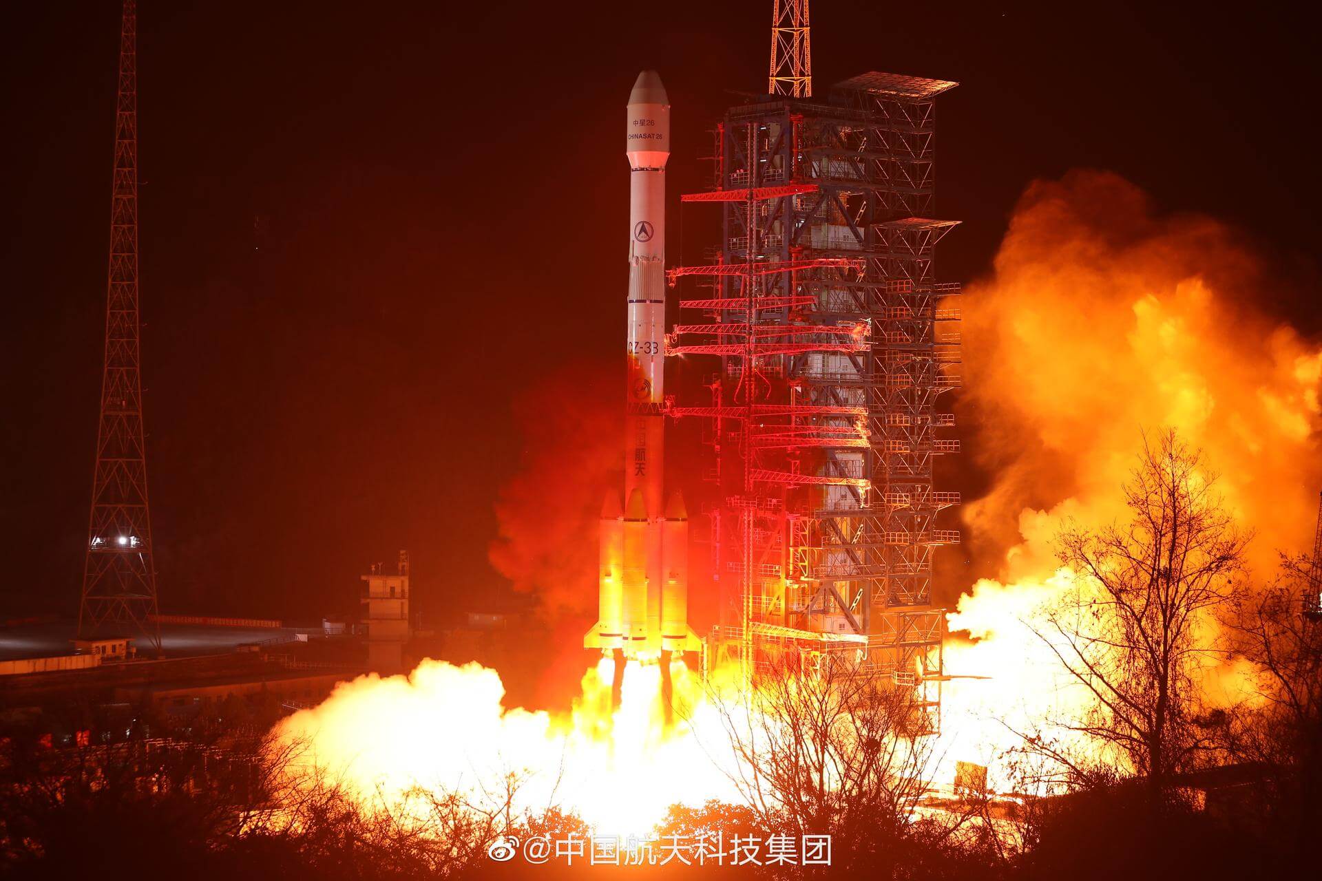
Tianlian 2-06

© China Aerospace Science and Technology Corporation

All launches
China Aerospace Science and Technology Corporation

Tianlian 2-06

Success

Long March 3B/E
T-minus to liftoff

-

00

HOURS

:

00

MINUTES

:

00

SECONDS

Thursday July 23 2026, 12:00:00 UTC
StatusSuccess
VehicleLong March 3B/E
OrbitGeostationary Transfer Orbit
PadLaunch Complex 2 (LC-2)
Recap room
Be the first here
Relive it
Loading map…

Mission

Tianlian is a Chinese data tracking and relay communications geostationary satellite series. The TL 2 (Tian Lian 2) satellites represent the second generation of this relay satellite network, and is based on the DFH-4 Bus, a three-axis-stabilized telecommunications satellite platform. TL 2 will be used to support real-time communications between orbiting satellites and ground control stations. This system will replace the current network of ground-based space tracking and telemetry stations and space tracking ships.

Quick facts

VehicleLong March 3B/E
OrbitGeostationary Transfer Orbit
PadLaunch Complex 2 (LC-2)
SiteXichang Satellite Launch Center, People's Republic of China
WindowThursday July 23 2026, 11:52:00 UTC→Thursday July 23 2026, 12:54:00 UTC

Vehicle

FamilyLong March
Height56.3 m
Diameter3.4 m
Stages3
ReusableNo
LEO capacity12,000 kg
Track record76/78 successful

Launch CodexDossier

Every source for this mission in one place — news, social, references, notes & the exact timeline.

Explore
Q

Q's read

Jellyfish potentialMap & details →

Vivid

Hazards (3)
  • A2002/26 NOTAMN Q) VOMF/QWLLW/IV/BO/W/000/999/ A) VOMF B) 2607010830 C) 2607291045 D) 01 08 22 29 0830-1045 15 0230-1045 23 24 1130-1715 E) GPS SONDE HIGH ALT BALLOON ASCENT FM THUMBA EQUATORIAL ROCKET LAUNCHING STN (TERLS) RANGE. LAUNCH COORD: ?083200N 0765218E DESCRIPTION: ?WHITE ORDINARY MET BALLOON WITH 2M DIAMETER INSTR WT: ?GPS SONDE 900GRAM-1800 GRAM MAX ALT EXP:?32 KM TRANSPONDER FREQ:400MHZ-405MHZ RATE OF ASCENT:?4-5 MPS RATE OF DESCENT?25 MPS (UPTO 20KM) ? ?5 MPS (BLW 20KM) EXP FLOATING TIME: 0215 HR F) GND G) UNL
  • P3498/26 NOTAMN Q)RJJJ/QXXXX/IV/NBO/E/000/999/2208N12739E029 A)RJJJ B)2607231155 C)2607231300 E)DUE TO AN AEROSPACE FLIGHT ACTIVITY, THE FLIGHT SAFETY OF THE AIRCRAFT IN FOLLOWING AREA MAY BE AFFECTED THRU JUL 23 2026,1155-1300 AREA: 2206N12810E - 2225N12714E - 2210N12708E - 2151N12804E - 2206N12810E ALTITUDE: SFC - UNL RMK:ATC WILL NOT CLEAR IFR FLT THRU THIS AREA FOR THE FLIGHT SAFETY F)SFC G)UNL
  • Q1725/26 NOTAMN Q)RJJJ/QARCH/IV/BO/E/000/999/3310N14118E999 A)RJJJ B)2607231155 C)2607231300 E)ALTN RTE ARE ESTABLISHED DUE TO AN AEROSPACE FLIGHT ACTIVITY. 1.FLT PLANNED RTE IS REQ TO BE FILED AS FLW TUNTO - A590 - GURAG (FOR RNP10) ALTN RTE: TUNTO - 2130N12830E - GURAG (FOR NON RNP10) ALTN RTE: TUNTO - 2200N12910E - 2100N12845E 2.SEE NOTAM RJAAYNYX P3498/26 F)SFC G)UNL
Acquiring satellite view…
General trajectory
Launch Complex 2 (LC-2)
Xichang Satellite Launch Center, People's Republic of China
Launching
East
96° · E
28.246, 102.027

Orbital elements (TLE)

2 element sets
Orbit
Apogee35,820 km
Perigee128 km
Period630.3 min
Inclination28.07°

Launch heading 96° · E from Tianlian 2-06 PO.

Parking orbitTianlian 2-06 PO› conelow
1 70150U 26169A 26204.50694444 .00000000 00000-0 00000-0 0 9997
2 70150 28.0680 122.7942 0223281 194.8871 285.0000 16.00984975 00
OrbitTianlian 2-06low
1 70150U 26169A 26204.51734954 .00000000 00000-0 00000-0 0 9999
2 70150 28.0680 122.7941 7328142 179.2138 000.0000 02.28448474 00

Pre-launch TLEs from Dillon's Space Page. Estimated before flight — the real orbit is confirmed post-launch.